

Welcome to scilands GmbH
Company for the Processing of Digital Landscapes
")
")
BSFZ seal
We are delighted to have received the BSFZ seal again – an award for companies recognized as research-active by the Research Allowance Certification Authority (BSFZ). As in previous years, the seal confirms our continuous work on new methods and tools in digital terrain analysis, hydrological modeling, and automated GIS processing.
For scilands, research and development is not a side project, but the core of our work – because only through our own methodological development can we offer our customers solutions that go beyond the state of the art.
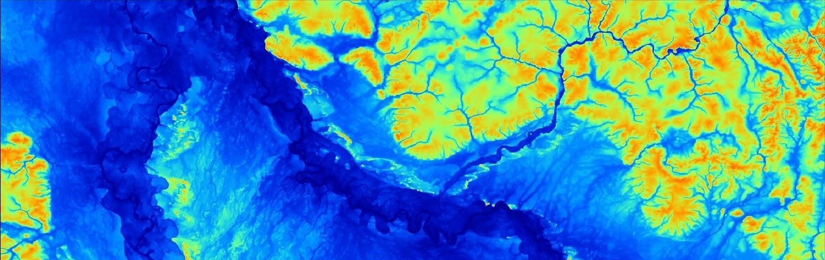
Rooted to the soil
Through the merger with the 'Office for Soil Science Services' and the addition of graduate geographer Stephan Melms to the management of our company, scilands GmbH will have further expertise in the field of...
>>> Soil function assessments
>>> Soil mapping
>>> Soil sampling
>>> Soil science construction supervision
After years of successful cooperation between our companies, this step was simply the logical next step. Further information about Mr. Melms' previous work can be found on the website. www.dipl-geograph-stephan-melms.de.
We look forward to continued successful collaboration and many exciting projects...
scilands GmbH...
...we offer customized solutions for every challenge in geographic information systems and geodata. From classic terrain analysis and landscape modeling to innovative strategies for your specific requirements, we model, automate, and optimize vector and raster datasets, as well as terrain, water, and soil databases, with competence and reliability. While SAGA-GIS is a core tool for us, our expertise spans the entire field of geoinformatics. Our team possesses extensive experience in geodata management, programming, automation, and remote sensing. Since 1998, we have been supporting customers and partners in research, government, and the private sector with our expertise, passionately developing: 'scientific landscapes'
Products
The product range of scilands GmbH has been growing steadily for over 25 years and has always remained up-to-date and innovative. Get an overview of our range on our product page...
Team
On the one hand, our employees are pioneers in geoinformatics who have continually followed and shaped the development of the discipline. On the other hand, our young developers expand our company profile...
GIS Training
Scilands GmbH offers training courses for beginners and for deepening knowledge of GIS for open source GIS-systems like SAGA and QGIS under experienced guidance.
Migration
We migrate proven applications from obsolete or discontinued platforms to future-proof open-source architectures and modern API-based GIS systems..
AI and Machine Learning
In addition to established methods, we also use artificial intelligence and machine learning to model complex systems, provided their use is appropriate.