Kurse
Schulungen von Open-Source-GIS (SAGA).
Wir bieten Kurse zu folgenden Themenbereichen an:
- Reliefanalyse:
- Hydrologie
- Bodenkunde
- Fernerkundung (Beginner
und Advanced)
- Einführungskurs
- Automatisierung
Wir stellen Ihnen aber auch gerne ein individuelles auf Ihre Anforderungen zugeschnittenes Programm zusammen. Sprechen Sie uns an!
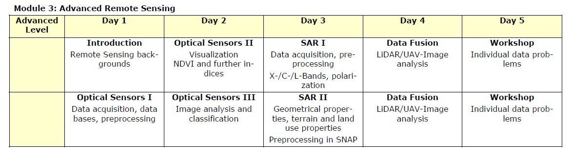
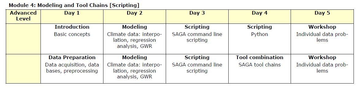
Beispiele für vier verschiedene Wochenkurse, die einzeln oder am Stück buchbar sind: